Beyond Sight

Our Services

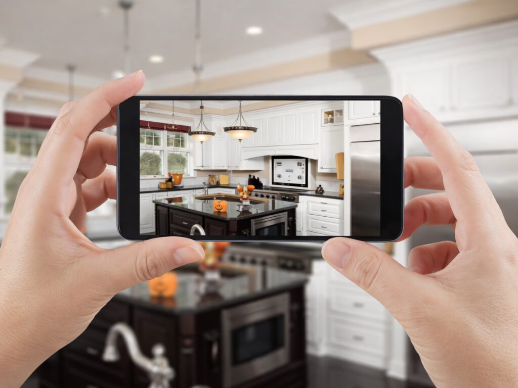
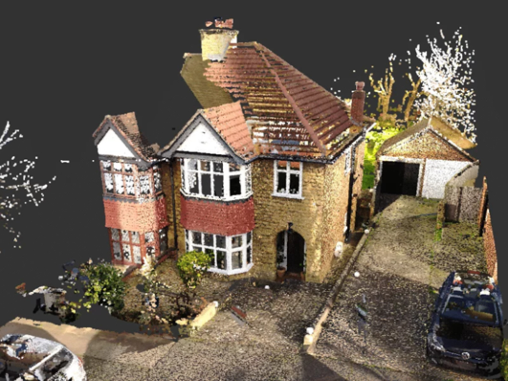
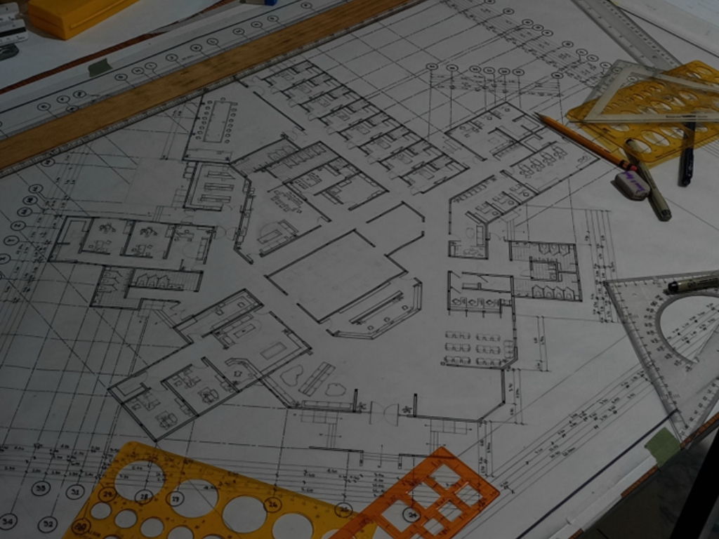
These are our professional services and technical capabilities. We specialize in the accurate capture and translation of real-world spaces into dependable digital resources for professional use.

What We Offer

Each service offered by Beyond Sight is designed to help clients better understand, present, and work with physical spaces through accurate digital representation.

3D BIM Models

High-accuracy LiDAR scanning used to capture physical spaces and create a detailed digital twin of the environment. This forms the foundation for all other services.

3D BIM Models

We convert scan data into an intelligent 3D Building Information Model (BIM) that accurately represents the geometry, layout, and key building elements. This model becomes a reliable working file for design development, coordination, and technical documentation.

Estimated Timeline: Model creation timelines vary depending on site size, complexity, and required outputs; larger or more detailed projects may require extended processing time.

Example: Use a BIM model of an existing office or building to produce coordinated drawings, test design changes, extract quantities, and support renovations or future upgrades—all from a single, accurate digital source.
Request A Quote

Guided Virtual Walkthrough

A professionally curated walkthrough that highlights key features of a property or space, ideal for remote viewing, presentations, and marketing purposes.

Guided Virtual Walkthrough

A curated, video-style walkthrough built from your 3D scan. We guide viewers through key areas and highlight the best features—ideal for marketing and presentations without viewers “getting lost.”

Estimated Timeline: Typically delivered after the scan is processed—timing depends on scope and editing requirements.

Example: A guided “mini film” walkthrough of a venue or property for a website listing or social media.
Request A Quote

Point Cloud Data

Detailed point cloud data generated from LiDAR scans, consisting of millions of spatial data points used for modeling, planning, and technical workflows.

Point Cloud Data

High-density point cloud files generated from the scan (e.g., .E57 / .RCP / .RCS) for accurate spatial analysis, modelling, clash detection, and design workflows in tools like Revit/AutoCAD/SketchUp.

Estimated Timeline: Typical processing turnaround (depending on area): • Up to 1,000 sqm: 2–3 business days • 2,500: 2–3 business days • 5,000: 3–4 business days • 10,000+: 4–6 business days.

Example: Import the point cloud into Revit/Navisworks to coordinate disciplines and catch clashes before construction.
Request A Quote

2D As Built drawings

Accurate floor plans created from scan data, suitable for planning, documentation, and integration into architectural workflows.

2D As Built drawings

We convert scan data into accurate 2D as-built drawings (PDF/DWG) and, where required, a 3D Revit BIM model to support planning, renovations, and council-ready documentation.

Estimated Timeline: Drawing up of 2D as-built plans takes place after site capture, with timelines varying according to project size and complexity. .

Example: Generate verified floorplans, elevations, and sections for municipal submissions or contractor pricing.
Request A Quote

Media & Visual Content

High-quality still images, panoramic views, short-form videos, and rendered visuals extracted directly from scan data for a wide range of communication and presentation uses. Optional drone photography and video can be added to provide aerial views, external context, and site-wide coverage where required.

Media & Visual Content

High-quality visuals created from scan data—4K stills, HDR exports, 360° panoramas, and optional drone photo/video add-ons for marketing, reports, and presentations.

Estimated Timeline: Typical delivery (depending on area): 1–2 days (≤500 sqm) up to 6–7 days (10,000+ sqm).

Example: A set of branded 4K images + panoramas for brochures, listings, investor decks, or progress updates.
Request A Quote

Virtual Tours

Interactive virtual tours that allow users to explore spaces online, featuring dollhouse views, measurements, and information hotspots.

Virtual Tours

An interactive 3D virtual tour where users explore your space online with dollhouse view, floorplan view, measurements, and info hotspots (tags)—great for remote viewing and faster decisions.

Estimated Timeline: Delivered after scan processing; overall turnaround varies by property size and scope (often 1–2 weeks for full project delivery depending on what’s included).

Example: A full interactive tour for a real estate listing or facility handover, with tagged notes for stakeholders.
Request A Quote

Results That Speak for Themselves

Our clients use immersive 3D models and virtual experiences to clearly communicate spaces, reduce uncertainty, and support faster, more informed decisions.

    David L.
    David L.

    Real Estate Agent

    “The virtual tour made it much easier to show the property to clients who couldn’t visit in person. The space was clear, accurate, and easy to navigate, which helped speed up discussions and decision-making.”

      Michael R.
      Michael R.

      Property Consultant

      “The LiDAR scan and point cloud data were clear and easy to work with. Having accurate measurements upfront saved time and reduced the need for repeated site visits.”

        Jason M.
        Jason M.

        Project Coordinator

        “Beyond Sight explained the process clearly and delivered exactly what was discussed. The outputs were easy to understand and worked well for our planning requirements.”

        Ready to Capture Your Space in Accurate 3D?

        Whether you need a virtual tour, accurate floor plans, or detailed scan data, Beyond Sight will guide you through the process and deliver outputs suited to your requirements.

        Frequently Asked Questions

        We understand that LiDAR scanning and virtual tours can be unfamiliar to many clients. Below are answers to some of the most common questions we receive about our services, process, and deliverables.

        Email Address

        info@beyondsight.co.za

        Phone Number

        (+27) 79-854-6148

        We scan a wide range of property types including residential homes, commercial offices, retail spaces, industrial facilities, educational buildings, and hospitality venues. Our workflow adapts to both small single-storey dwellings and large multi-level or complex structures.